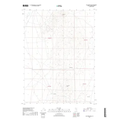
2018 Map of Hot Springs Peak
USGS Topo · Published 2018About this map
Hot Springs Peak dominates this high-desert landscape in the Great Basin, where the peaks of the Hot Springs Range rise sharply above the floor of Eden Valley. This 2018 survey reveals a terrain defined by sparse water sources and topographic barriers, such as Stewart Gap and Ling Canyon. The presence of Reed Spring and Scott Spring suggests the vital importance of reliable water for livestock and wildlife in this arid region of Humboldt County. In the northwest, the Little Humboldt River provides a primary drainage route, while the map's grid system shows the expansive Public Land Survey sections common to the American West. The lack of built settlements reflects the area's ongoing character as open rangeland or protected public land, where the topography itself dictates the movement of people and resources.
Find a feature on this map
12 named features on this map. Tap any name to fly to it.
Don’t see what you’re looking for? This feature index may not catch every label — zoom into the map to look around manually.
Map Details
Editions of this 2018 Hot Springs Peak Map
This is the sole edition of this map. No revisions or reprints were ever made.
Other maps of this area

1882 · Paradise
USGS Topo · 1:250,000

1893 · Paradise
USGS Topo · 1:250,000

1945 · Osgood Mountains
USGS Topo · 1:62,500

1945 · Hot Springs
USGS Topo · 1:62,500

1947 · Osgood Mountains
USGS Topo · 1:62,500

1947 · Hot Springs Peak
USGS Topo · 1:62,500

1955 · McDermitt
USGS Topo · 1:250,000

1958 · Paradise Valley
USGS Topo · 1:62,500

1959 · McDermitt
USGS Topo · 1:250,000

1959 · Bliss
USGS Topo · 1:62,500