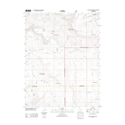
2013 Map of Hotchkiss Reservoir
USGS Topo · Published 2013About this map
Uncompahgre National Forest dominates this landscape in southwestern Colorado, where the borders of Montrose, Ouray, and San Miguel counties meet. The area is defined by a complex network of high-altitude water management and livestock infrastructure. Numerous small-scale water bodies, including Hotchkiss Reservoir, Geyser Reservoir, and Tikka Reservoir, are scattered throughout the terrain, suggesting a seasonal grazing and irrigation economy. The map identifies several specialized locations such as Hofmann Ranch and Spear Ranch, along with established camps like Jutten Camp and Galloway Camp. A notable industrial marker, the Sawdust Pile, appears near the northern edge, while trails such as the Rim Trail and Clear Creek Trail navigate the plateaus and valleys like Hanks Valley. This survey captures a moment in the modern management of these public lands and private holdings.
Find a feature on this map
58 named features on this map. Tap any name to fly to it.
Don’t see what you’re looking for? This feature index may not catch every label — zoom into the map to look around manually.
Map Details
Editions of this 2013 Hotchkiss Reservoir Map
This is the sole edition of this map. No revisions or reprints were ever made.
Other maps of this area

1909 · Montrose
USGS Topo · 1:125,000

1911 · Montrose
USGS Topo · 1:125,000

1953 · Placerville
USGS Topo · 1:24,000

1956 · Montrose
USGS Topo · 1:250,000

1956 · Moab
USGS Topo · 1:250,000

1959 · Moab
USGS Topo · 1:250,000

1959 · Montrose
USGS Topo · 1:250,000

1960 · Montrose
USGS Topo · 1:250,000

1960 · Moab
USGS Topo · 1:250,000

1962 · Moab
USGS Topo · 1:250,000