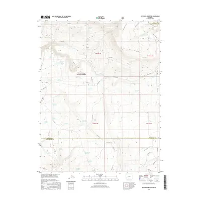
2016 Map of Hotchkiss Reservoir
USGS Topo · Published 2016About this map
Uncompahgre National Forest dominates this high-altitude landscape, where complex water management systems define the terrain. The map reveals an intricate network of small irrigation and stock reservoirs, including Hotchkiss Reservoir, Loss Reservoir, and Barnes Mill Reservoir, which capture runoff from the surrounding peaks. This reliance on stored water is a hallmark of Western high-country ranching and land use. Evidence of former timber activity appears near the boundary with Ouray County at a site labeled Sawdust Pile. A dense system of pack trails and forest roads, such as Horse Thief Trl and Tattletail Trl, crisscross the area, while family-named landmarks like Edmondson Spring and Stuarts Springs provide clues to early homesteaders who occupied these drainages. The convergence of Montrose and San Miguel counties in the southern portion of the sheet further marks the area's administrative complexity.
Find a feature on this map
63 named features on this map. Tap any name to fly to it.
Don’t see what you’re looking for? This feature index may not catch every label — zoom into the map to look around manually.
Map Details
Editions of this 2016 Hotchkiss Reservoir Map
This is the sole edition of this map. No revisions or reprints were ever made.
Other maps of this area

1909 · Montrose
USGS Topo · 1:125,000

1911 · Montrose
USGS Topo · 1:125,000

1953 · Placerville
USGS Topo · 1:24,000

1956 · Montrose
USGS Topo · 1:250,000

1956 · Moab
USGS Topo · 1:250,000

1959 · Moab
USGS Topo · 1:250,000

1959 · Montrose
USGS Topo · 1:250,000

1960 · Montrose
USGS Topo · 1:250,000

1960 · Moab
USGS Topo · 1:250,000

1962 · Moab
USGS Topo · 1:250,000