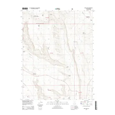
2014 Map of Hotel Rock
USGS Topo · Published 2014About this map
Hotel Rock stands as a prominent landmark in this section of San Juan County, where the high desert plateau is deeply incised by complex drainage systems. The landscape is defined by the transition from the elevated Manti-La Sal National Forest at Milk Ranch Point down into the broad expanses of Texas Flat and the canyon bottoms. Significant watercourses like Comb Wash and Butler Wash frame the central topographic features, while smaller seasonal draws such as Dog Tanks Draw and Whiskers Draw highlight the region's hydraulic character.
Find a feature on this map
50 named features on this map. Tap any name to fly to it.
Don’t see what you’re looking for? This feature index may not catch every label — zoom into the map to look around manually.
Map Details
Editions of this 2014 Hotel Rock Map
This is the sole edition of this map. No revisions or reprints were ever made.
Other maps of this area

1886 · Abajo
USGS Topo · 1:250,000

1892 · Abajo
USGS Topo · 1:250,000

1893 · Abajo
USGS Topo · 1:250,000

1935 · Elk Ridge
USGS Topo · 1:96,000

1940 · Elk Ridge
USGS Topo · 1:125,000

1954 · Elk Ridge 4 NW
USGS Topo · 1:24,000

1954 · Elk Ridge 3 NE
USGS Topo · 1:24,000

1954 · Elk Ridge 3 SE
USGS Topo · 1:24,000

1954 · Bears Ears
USGS Topo · 1:62,500

1956 · Cortez
USGS Topo · 1:250,000