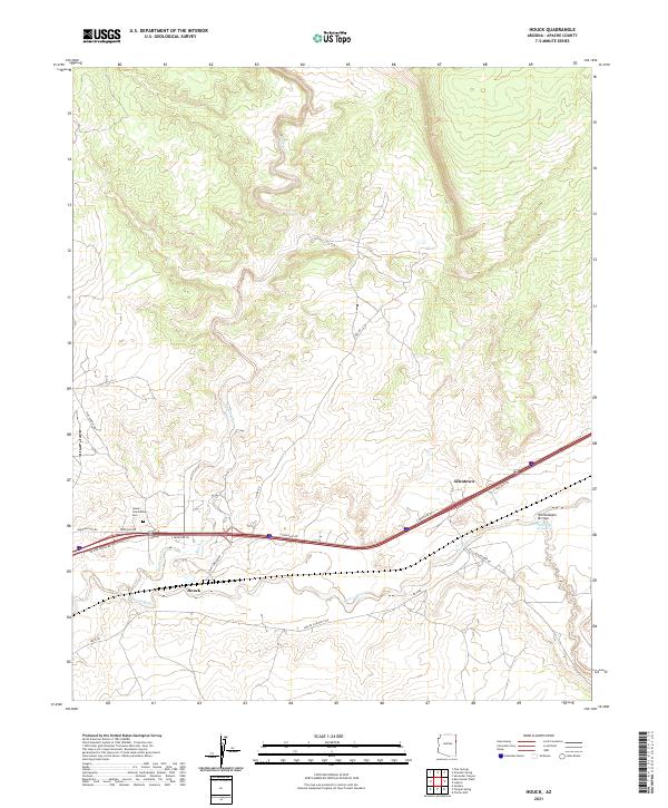
2021 Map of Houck
USGS Topo · Published 2021About this map
Houck and the neighboring settlement of Allentown serve as the primary hubs in this high-desert landscape, situated along the critical transit corridor formed by the Puerco River. The topography is defined by the convergence of major drainage systems, where Black Creek joins the Puerco near the southern edge of the survey area, and the Whitewater Arroyo cuts through the eastern terrain. This 2021 update reveals a network of local thoroughfares such as Allentown Rd and Apache Co Road 7240 that navigate the varied elevations of the high plateau.
Find a feature on this map
23 named features on this map. Tap any name to fly to it.
Don’t see what you’re looking for? This feature index may not catch every label — zoom into the map to look around manually.
Map Details
Editions of this 2021 Houck Map
This is the sole edition of this map. No revisions or reprints were ever made.
Other maps of this area

1886 · Fort Defiance
USGS Topo · 1:250,000

1892 · Fort Defiance
USGS Topo · 1:250,000

1954 · Gallup
USGS Topo · 1:250,000

1958 · Gallup
USGS Topo · 1:250,000

1959 · Gallup
USGS Topo · 1:250,000

1962 · Gallup
USGS Topo · 1:250,000

1967 · Gallup
USGS Topo · 1:250,000

1971 · Burntwater Wash
USGS Topo · 1:24,000
1971 · Chafin Well
USGS Topo · 1:24,000
1971 · Uranium Spring
USGS Topo · 1:24,000
Featured Places
- Fort Defiance Agency
- Allentown, Fort Defiance Agency
- Houck, Fort Defiance Agency
- Apache County, AZ
- United States