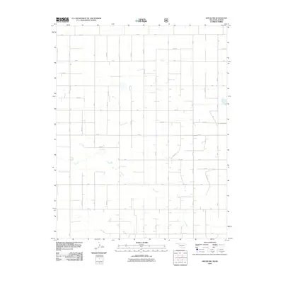
2010 Map of Hough NW
USGS Topo · Published 2010About this map
Cow Creek meanders through the heart of this High Plains landscape, which is defined by an orderly grid of section lines and range roads. The drainage of Cow Creek provides the primary relief in an otherwise flat agricultural region near the Oklahoma-Kansas border. The settlement pattern here is sparse, characterized by occasional farmsteads and rural dwellings connected by a network of numbered and lettered roads such as A Blvd, Road E, and Mile 21. This 2010 USGS survey documents the area's modern land divisions and water resources, including small stock ponds scattered among the large cultivated tracts. The systematic numbering of routes like N0725 Rd and E0015 Rd reflects the methodical surveying of Texas County, highlighting the transition from traditional named roads to the standardized county grid system used in the 21st century.
Find a feature on this map
34 named features on this map. Tap any name to fly to it.
Don’t see what you’re looking for? This feature index may not catch every label — zoom into the map to look around manually.
Map Details
Editions of this 2010 Hough NW Map
This is the sole edition of this map. No revisions or reprints were ever made.
Other maps of this area

1954 · Perryton
USGS Topo · 1:250,000

1955 · Dodge City
USGS Topo · 1:250,000

1958 · Perryton
USGS Topo · 1:250,000

1958 · Dodge City
USGS Topo · 1:250,000

1959 · Dodge City
USGS Topo · 1:250,000

1973 · Eva SE
USGS Topo · 1:24,000

1973 · Hough SW
USGS Topo · 1:24,000

1973 · Hough NE
USGS Topo · 1:24,000

1973 · Hough NW
USGS Topo · 1:24,000
1973 · Eva NE
USGS Topo · 1:24,000