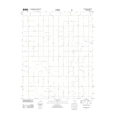
2012 Map of Hough NW
USGS Topo · Published 2012About this map
Cow Cr winds through the high plains landscape of the Oklahoma Panhandle, carving a subtle drainage across an otherwise orderly grid of section lines. This portion of Texas County exhibits the characteristic agricultural footprint of the region, where the vastness of the plains is organized by a meticulous network of rural roads such as A Rd, Road F, and A Blvd. The map reveals a landscape dominated by large-scale land management, where the geometric precision of routes like E0090 Rd and Co Rd 18 provides the only structural framework for the expansive prairie terrain. The relationship between the meandering creek bed and the rigid section-line roads illustrates the intersection of natural hydrology and the systematic human division of the American West.
Find a feature on this map
38 named features on this map. Tap any name to fly to it.
Don’t see what you’re looking for? This feature index may not catch every label — zoom into the map to look around manually.
Map Details
Editions of this 2012 Hough NW Map
This is the sole edition of this map. No revisions or reprints were ever made.
Other maps of this area

1954 · Perryton
USGS Topo · 1:250,000

1955 · Dodge City
USGS Topo · 1:250,000

1958 · Perryton
USGS Topo · 1:250,000

1958 · Dodge City
USGS Topo · 1:250,000

1959 · Dodge City
USGS Topo · 1:250,000

1973 · Eva SE
USGS Topo · 1:24,000

1973 · Hough SW
USGS Topo · 1:24,000

1973 · Hough NE
USGS Topo · 1:24,000

1973 · Hough NW
USGS Topo · 1:24,000
1973 · Eva NE
USGS Topo · 1:24,000