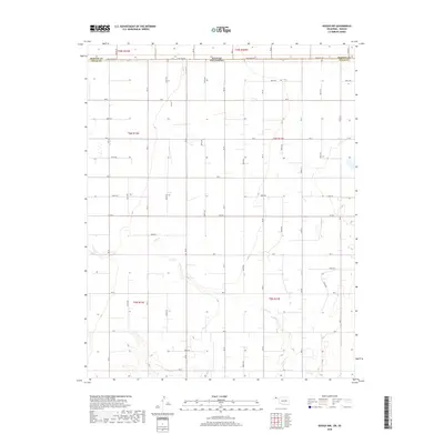
2018 Map of Hough NW
USGS Topo · Published 2018About this map
The high plains of the Oklahoma Panhandle meet the Kansas border in this 2018 survey of northwestern Texas County. The landscape is defined by a rigid grid of section roads and the meandering path of Cow Cr, which cuts across the southern half of the quadrangle. This area remains primarily agricultural, with the map recording the precise boundaries of t6n r12e and t6n r13e alongside the state line. At the northern edge, State Line Rd serves as the literal divide between Texas Co, Oklahoma, and Morton Co, Kansas. The network of local routes, including Co Rd E and Rd F, provides access to the vast ranching and farming tracts that characterize this corner of the state.
Find a feature on this map
25 named features on this map. Tap any name to fly to it.
Don’t see what you’re looking for? This feature index may not catch every label — zoom into the map to look around manually.
Map Details
Editions of this 2018 Hough NW Map
This is the sole edition of this map. No revisions or reprints were ever made.
Other maps of this area

1954 · Perryton
USGS Topo · 1:250,000

1955 · Dodge City
USGS Topo · 1:250,000

1958 · Perryton
USGS Topo · 1:250,000

1958 · Dodge City
USGS Topo · 1:250,000

1959 · Dodge City
USGS Topo · 1:250,000

1973 · Eva SE
USGS Topo · 1:24,000

1973 · Hough SW
USGS Topo · 1:24,000

1973 · Hough NE
USGS Topo · 1:24,000

1973 · Hough NW
USGS Topo · 1:24,000
1973 · Eva NE
USGS Topo · 1:24,000