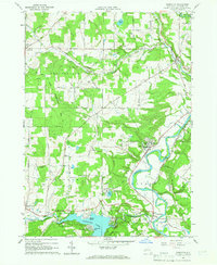
1964 Map of Houghton
USGS Topo · Published 1966About this map
The Genesee River cuts a deep valley through this Allegany County landscape, where the academic and religious community at Houghton serves as a local anchor. The mid-1960s terrain is marked by the presence of Houghton Academy and the Houghton College Airfield, while to the south, the waters of Rushford Lake are held by the Caneadea Dam. This man-made reservoir features recreational spots like Balcom Beach and the Hillcrest Conservation Club, contrasting with the more traditional agricultural and industrial patterns of the surrounding townships.
Find a feature on this map
77 named features on this map. Tap any name to fly to it.
Don’t see what you’re looking for? This feature index may not catch every label — zoom into the map to look around manually.
Map Details
Editions of this 1964 Houghton Map
2 editions found
Other maps of this area

1905 · Portage
USGS Topo · 1:62,500

1906 · Angelica
USGS Topo · 1:62,500

1923 · Arcade
USGS Topo · 1:62,500

1924 · Franklinville
USGS Topo · 1:62,500

1925 · Arcade
USGS Topo · 1:62,500

1941 · Angelica
USGS Topo · 1:62,500

1942 · Franklinville
USGS Topo · 1:62,500

1943 · Portageville
USGS Topo · 1:24,000

1943 · Pike
USGS Topo · 1:24,000

1944 · Pike
USGS Topo · 1:31,680