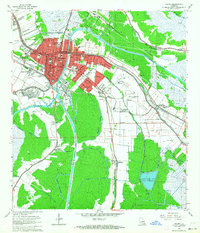
1963 Map of Houma
USGS Topo · Published 1964About this map
Houma serves as the bustling hub of Terrebonne Parish in this early 1960s survey, defined by its intricate network of bayous and industrial canals. The city's residential and commercial core is flanked by the Houma Gas Field and the expansive Houma-Terrebonne Airport, illustrating the post-war energy and aviation expansion in the region. To the south, the landscape transitions into a watery grid of drainage and navigation projects, including the Houma Navigation Canal and St Louis Canal, which cut through the marshy terrain toward smaller outlying settlements like Crozier, Ashland, and Woodlawn. Numerous community landmarks are documented, from the Agricultural Experiment Station to local spiritual sites such as St Louis Ch and Jerusalem Ch. The map provides a clear look at the area's specialized education and infrastructure, noting sites like the South Terrebonne High Sch and several sewage disposal ponds.
Find a feature on this map
60 named features on this map. Tap any name to fly to it.
Don’t see what you’re looking for? This feature index may not catch every label — zoom into the map to look around manually.
Map Details
Editions of this 1963 Houma Map
4 editions found
Other maps of this area

1892 · Gibson
USGS Topo · 1:62,500

1892 · Houma
USGS Topo · 1:62,500

1894 · Bayou De Large
USGS Topo · 1:62,500

1894 · Dulac
USGS Topo · 1:62,500

1897 · Gibson
USGS Topo · 1:62,500

1932 · Houma SE
USGS Topo · 1:31,680

1932 · Houma SW
USGS Topo · 1:31,680

1932 · Houma NE
USGS Topo · 1:31,680

1932 · Houma NW
USGS Topo · 1:31,680

1935 · Theriot
USGS Topo · 1:31,680