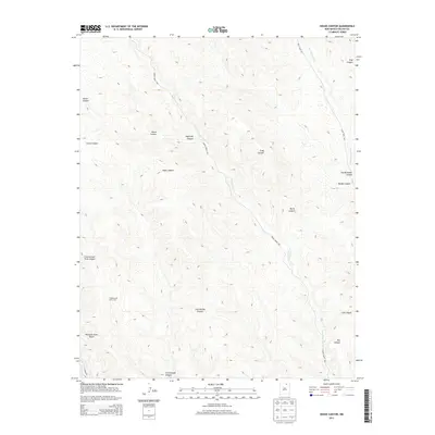
2013 Map of House Canyon
USGS Topo · Published 2013About this map
Philmont Scout Ranch anchors the southwestern portion of this high-elevation landscape in Colfax County, where the terrain is defined by a dense network of drainages and named canyons. Remote outposts like Cottonwood Cow Camp reflect the region's enduring ranching heritage, situated near the headwaters of Cottonwood Canyon. The map reveals a complex hydrography dominated by Cerrososo Cr and Van Bremmer Cr, which carve through the plateau to form distinctive features such as Stag Canyon and Burnt Canyon.
Find a feature on this map
21 named features on this map. Tap any name to fly to it.
Don’t see what you’re looking for? This feature index may not catch every label — zoom into the map to look around manually.
Map Details
Editions of this 2013 House Canyon Map
This is the sole edition of this map. No revisions or reprints were ever made.
Other maps of this area

1954 · Raton
USGS Topo · 1:250,000

1955 · Cimarron
USGS Topo · 1:62,500

1955 · Ute Park
USGS Topo · 1:62,500

1958 · Raton
USGS Topo · 1:250,000

1962 · Ash Mountain
USGS Topo · 1:62,500

1962 · Casa Grande
USGS Topo · 1:62,500

1981 · Raton
USGS Topo · 1:100,000

1982 · Wheeler Peak
USGS Topo · 1:100,000
1986 · Van Bremmer Park
USGS Topo · 1:24,000
1986 · Caliente Canyon South
USGS Topo · 1:24,000