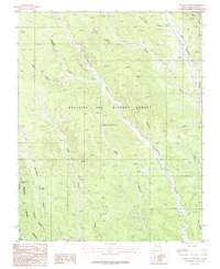
1987 Map of House Canyon
USGS Topo · Published 1987About this map
The Beaubien and Miranda Grant (Maxwell) encompasses much of this high-elevation landscape in Colfax County, where deep drainages like Cerrososo Canyon and Chase Canyon carve through the terrain. This late twentieth-century survey captures the region as it served as a vital part of the Philmont Scout Ranch Boundary, a massive wilderness area dedicated to outdoor education and exploration.
Find a feature on this map
22 named features on this map. Tap any name to fly to it.
Don’t see what you’re looking for? This feature index may not catch every label — zoom into the map to look around manually.
Map Details
Editions of this 1987 House Canyon Map
This is the sole edition of this map. No revisions or reprints were ever made.
Other maps of this area

1954 · Raton
USGS Topo · 1:250,000

1955 · Cimarron
USGS Topo · 1:62,500

1955 · Ute Park
USGS Topo · 1:62,500

1958 · Raton
USGS Topo · 1:250,000

1962 · Ash Mountain
USGS Topo · 1:62,500

1962 · Casa Grande
USGS Topo · 1:62,500

1981 · Raton
USGS Topo · 1:100,000

1982 · Wheeler Peak
USGS Topo · 1:100,000
1986 · Van Bremmer Park
USGS Topo · 1:24,000
1986 · Caliente Canyon South
USGS Topo · 1:24,000