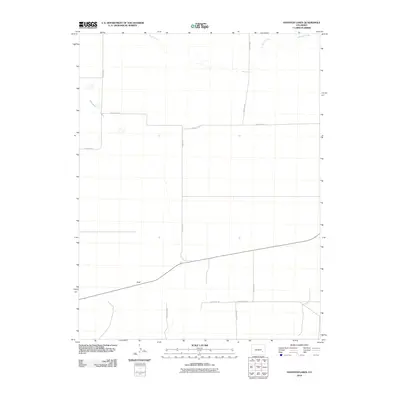
2010 Map of Houston Lakes
USGS Topo · Published 2010About this map
Houston Lakes and the intermittent flow of Sand Arroyo define this arid stretch of southeastern Colorado. This 2010 survey documents a landscape of sparse ranching settlements and expansive rural infrastructure, where isolated homesteads like Lewis Ranch and McIntosh Ranch sit amidst a grid of long-distance county roads. The small settlement of Heath serves as a navigational point along a route crossing the southern portion of the quadrangle. The terrain is largely characterized by dry washes and drainage patterns, including Mustang Creek in the northeastern corner, which reflect the region's reliance on seasonal water management. This map provides a precise record of the road network and property locations that supported agricultural operations in Otero County during the early 21st century.
Find a feature on this map
14 named features on this map. Tap any name to fly to it.
Don’t see what you’re looking for? This feature index may not catch every label — zoom into the map to look around manually.
Map Details
Editions of this 2010 Houston Lakes Map
This is the sole edition of this map. No revisions or reprints were ever made.
Other maps of this area

1891 · Catlin
USGS Topo · 1:125,000

1891 · Las Animas
USGS Topo · 1:125,000

1893 · Las Animas
USGS Topo · 1:125,000

1893 · Catlin
USGS Topo · 1:125,000

1954 · Meredith Hill
USGS Topo · 1:24,000

1954 · Lamar
USGS Topo · 1:250,000

1955 · Mc Intosh Ranch
USGS Topo · 1:24,000
1955 · Lewis Ranch
USGS Topo · 1:24,000

1958 · Lamar
USGS Topo · 1:250,000

1974 · Arlington NE
USGS Topo · 1:24,000