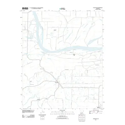
2011 Map of Houston
USGS Topo · Published 2011About this map
The Houston settlement and its surrounding countryside are defined by the convergence of several major water systems in central Arkansas. The Arkansas River flows broadly through the northern section, creating the expansive Sandtown Bottoms and feeding into smaller tributaries like Cypress Creek and White Branch. To the south, the Fourche LaFave River meanders toward the Council Bluffs Bridge, marking a distinct change in the local topography as the land rises toward Copperas Gap and the heights of Toms Mountain.
Find a feature on this map
58 named features on this map. Tap any name to fly to it.
Don’t see what you’re looking for? This feature index may not catch every label — zoom into the map to look around manually.
Map Details
Editions of this 2011 Houston Map
This is the sole edition of this map. No revisions or reprints were ever made.
Other maps of this area

1889 · Morrilton No. 3
USGS Topo · 1:62,500

1890 · Benton
USGS Topo · 1:125,000

1892 · Morrillton
USGS Topo · 1:125,000

1894 · Morrillton
USGS Topo · 1:125,000

1894 · Benton
USGS Topo · 1:125,000

1955 · Little Rock
USGS Topo · 1:250,000

1956 · Little Rock
USGS Topo · 1:250,000

1956 · Russellville
USGS Topo · 1:250,000

1960 · Little Rock
USGS Topo · 1:250,000

1961 · Menifee
USGS Topo · 1:24,000