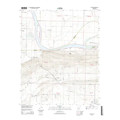
2014 Map of Houston
USGS Topo · Published 2014About this map
Sandtown Bottoms and Portland Bottoms dominate the low-lying agricultural landscape north of the Arkansas River, where the Morrilton Cutoff reveals the river's shifting path over time. In the center of the sheet, the terrain rises sharply into Bunker Hill and Perry Mtn, creating a distinct topographical barrier between the river valley and the interior settlements. The town of Houston serves as a central hub, situated near the confluence of Ballard Cr and Mill Cr, while the community of Oppelo sits at the northwestern edge of the survey area.
Find a feature on this map
82 named features on this map. Tap any name to fly to it.
Don’t see what you’re looking for? This feature index may not catch every label — zoom into the map to look around manually.
Map Details
Editions of this 2014 Houston Map
This is the sole edition of this map. No revisions or reprints were ever made.
Other maps of this area

1889 · Morrilton No. 3
USGS Topo · 1:62,500

1890 · Benton
USGS Topo · 1:125,000

1892 · Morrillton
USGS Topo · 1:125,000

1894 · Morrillton
USGS Topo · 1:125,000

1894 · Benton
USGS Topo · 1:125,000

1955 · Little Rock
USGS Topo · 1:250,000

1956 · Little Rock
USGS Topo · 1:250,000

1956 · Russellville
USGS Topo · 1:250,000

1960 · Little Rock
USGS Topo · 1:250,000

1961 · Menifee
USGS Topo · 1:24,000