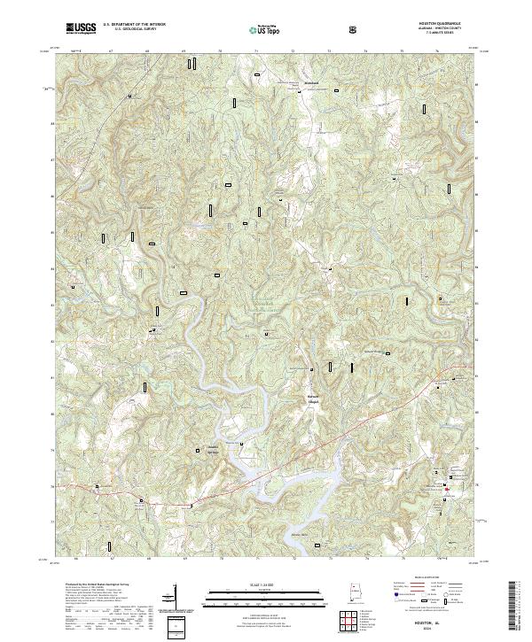
2024 Map of Houston
USGS Topo · Published 2024About this map
The William B. Bankhead National Forest covers much of this North Alabama landscape, where the Sipsey Fork of the West Fork Wild and Scenic River carves deep bends through the terrain. The map reveals a dense network of family history markers, including the Burdick Family Cemetery and Dragout - Old Watts Cemetery. Small communities such as Moreland and Barnett Chapel are defined by their local institutions, like the New Home Missionary Baptist Church and Houston Church of God. Numerous creeks and branches, including Grindstone Creek and Penitentiary Branch, feed the larger Sipsey Fork, illustrating the intricate drainage patterns that have dictated local settlement and road placement for generations in Winston County.
Find a feature on this map
87 named features on this map. Tap any name to fly to it.
Don’t see what you’re looking for? This feature index may not catch every label — zoom into the map to look around manually.
Map Details
Editions of this 2024 Houston Map
This is the sole edition of this map. No revisions or reprints were ever made.
Other maps of this area

1935 · Upshaw
USGS Topo · 1:24,000

1935 · Danville
USGS Topo · 1:48,000

1936 · Moulton
USGS Topo · 1:48,000

1938 · Danville
USGS Topo · 1:62,500

1940 · Mt Hope
USGS Topo · 1:62,500

1956 · Gadsden
USGS Topo · 1:250,000

1958 · Gadsden
USGS Topo · 1:250,000

1960 · Gadsden
USGS Topo · 1:250,000
1960 · Bee Branch
USGS Topo · 1:24,000
1960 · Grayson
USGS Topo · 1:24,000