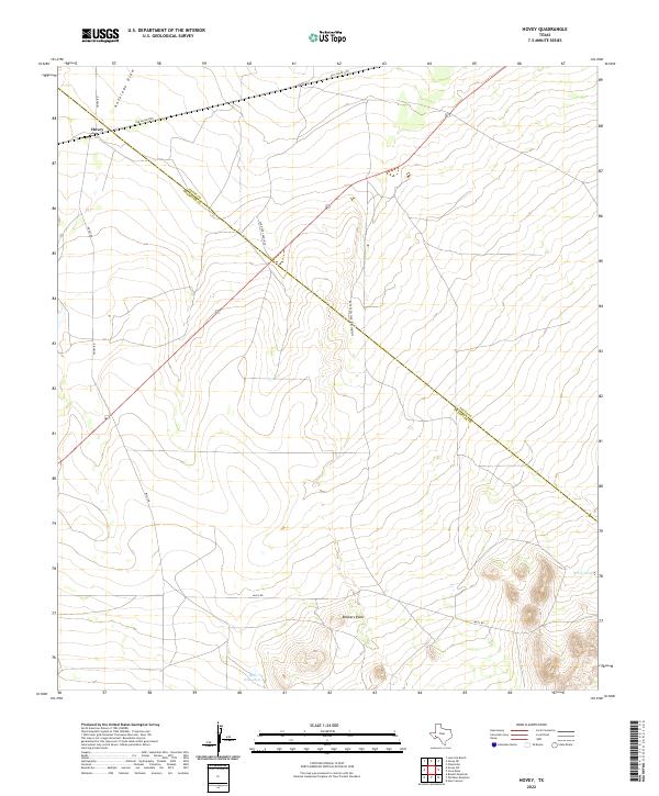
2022 Map of Hovey
USGS Topo · Published 2022About this map
Hovey serves as a lone point of reference in this arid expanse of West Texas, where the high desert terrain transitions between Pecos and Brewster counties. The landscape is defined by its drainage patterns and legendary landmarks, notably the topographic hideout of Robbers Roost and the winding descent of Gilliland Canyon. Historical ranching infrastructure is evident through family-named routes such as Old Hovey Ranch Co and remote water sources like Bull Waterhole and Perch Tank. This 2022 survey captures a rugged ranching economy where travel is still dictated by the paths of the Old Alpine Hwy and Antelope Draw, preserving the spatial relationships of a sparsely populated frontier region.
Find a feature on this map
11 named features on this map. Tap any name to fly to it.
Don’t see what you’re looking for? This feature index may not catch every label — zoom into the map to look around manually.
Map Details
Editions of this 2022 Hovey Map
This is the sole edition of this map. No revisions or reprints were ever made.
Other maps of this area

1923 · Hess Canyon
USGS Topo · 1:62,500

1923 · Altuda
USGS Topo · 1:62,500

1929 · Hovey
USGS Topo · 1:125,000

1954 · Fort Stockton
USGS Topo · 1:250,000

1958 · Fort Stockton
USGS Topo · 1:250,000

1973 · Fort Stockton
USGS Topo · 1:250,000
1980 · Chancellor
USGS Topo · 1:24,000

1980 · Cave Mesa
USGS Topo · 1:24,000

1980 · Hovey
USGS Topo · 1:24,000
1980 · Hovey SW
USGS Topo · 1:24,000