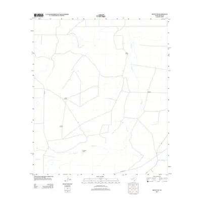
2012 Map of Hovey NE
USGS Topo · Published 2012About this map
Isolated ranchlands and critical water sources define this West Texas landscape in the northern reaches of the Trans-Pecos. The network of drainage basins, including Paisano Cr and Musquiz Cr, dictates the placement of infrastructure in this arid environment. Transportation through the area relies on the Old Alpine Hwy and Hovey Rd, which traverse the open range. The survival of local ranching operations is evidenced by the distribution of named water-pumping stations such as North Windmill, Webb Windmill, and Hackney Windmill. Natural landmarks like Antelope Draw provide the only significant topographic breaks in an otherwise expansive and utilitarian landscape, where water features like Burnt-House Cr remain the most vital landmarks for orientation.
Find a feature on this map
10 named features on this map. Tap any name to fly to it.
Don’t see what you’re looking for? This feature index may not catch every label — zoom into the map to look around manually.
Map Details
Editions of this 2012 Hovey NE Map
This is the sole edition of this map. No revisions or reprints were ever made.
Other maps of this area

1929 · Hovey
USGS Topo · 1:125,000

1954 · Fort Stockton
USGS Topo · 1:250,000

1958 · Fort Stockton
USGS Topo · 1:250,000

1970 · Belding SW
USGS Topo · 1:24,000

1970 · Deep Well Ranch
USGS Topo · 1:24,000

1970 · Deep Well Ranch SE
USGS Topo · 1:24,000

1973 · Fort Stockton
USGS Topo · 1:250,000
1980 · Chancellor
USGS Topo · 1:24,000

1980 · Cave Mesa
USGS Topo · 1:24,000

1980 · Hovey
USGS Topo · 1:24,000