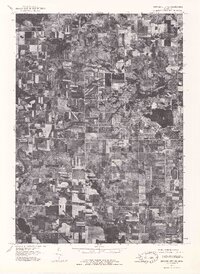
1976 Map of Howard City NE
USGS Topo · Published 1979About this map
Lakeview stands as the primary center of activity in this 1976 orthophoto, where the town's grid and development cluster around the eastern shore of Tamarack Lake. This aerial survey provides a rare visual record of the landscape as captured by the Michigan Department of Natural Resources and the USGS, showing the distinct transition between the concentrated village and the surrounding agricultural parcels. The drainage of Tamarack Creek winds through the central portion of the map, carving a path through a patchwork of woodlots and farm fields. Unlike traditional topographic maps, this orthophotograph offers researchers a literal view of the mid-1970s vegetation patterns and land use, revealing the exact footprint of farmsteads and the density of the lakeshore settlement.
Find a feature on this map
3 named features on this map. Tap any name to fly to it.
Don’t see what you’re looking for? This feature index may not catch every label — zoom into the map to look around manually.
Map Details
Editions of this 1976 Howard City NE Map
This is the sole edition of this map. No revisions or reprints were ever made.
Other maps of this area

1954 · Midland
USGS Topo · 1:250,000

1958 · Midland
USGS Topo · 1:250,000

1958 · Big Rapids
USGS Topo · 1:62,500

1959 · Midland
USGS Topo · 1:250,000

1959 · Howard City
USGS Topo · 1:62,500

1964 · Six Lakes
USGS Topo · 1:24,000

1964 · Langston
USGS Topo · 1:24,000

1964 · Mecosta
USGS Topo · 1:24,000

1966 · Midland
USGS Topo · 1:250,000

1976 · Big Rapids SE
USGS Topo · 1:24,000