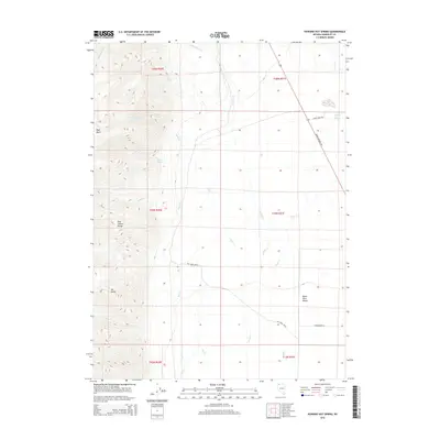
2015 Map of Howard Hot Spring
USGS Topo · Published 2015About this map
Howard Hot Spring sits at the base of the Pine Forest Range in this high-desert portion of Humboldt County. The landscape is defined by the sharp transition from the elevation of Mt Baldy down to the eastern expanse of the Black Rock Desert. Water remains the primary focal point of the area's geography, with seasonal drainages like Rattlesnake Cr and Granite Cr feeding into the basin. Remote ranching and land management are evident through the presence of the Big Creek Rnch and primitive access routes such as Sheep Camp Rd and Craig Moore Rd. These features, alongside Four Springs and Willow Spring, illustrate the critical importance of reliable water sources in an arid environment. The map also traces the path of Denio Highway 140, the primary modern corridor through this isolated region of northwestern Nevada.
Find a feature on this map
26 named features on this map. Tap any name to fly to it.
Don’t see what you’re looking for? This feature index may not catch every label — zoom into the map to look around manually.
Map Details
Editions of this 2015 Howard Hot Spring Map
This is the sole edition of this map. No revisions or reprints were ever made.
Other maps of this area

1886 · Disaster
USGS Topo · 1:250,000

1893 · Disaster
USGS Topo · 1:250,000

1954 · Vya
USGS Topo · 1:250,000

1958 · Vya
USGS Topo · 1:250,000

1961 · Quinn River Crossing
USGS Topo · 1:62,500

1961 · Trident Peak
USGS Topo · 1:62,500

1962 · Vya
USGS Topo · 1:250,000

1965 · Duffer Peak
USGS Topo · 1:62,500

1966 · Denio
USGS Topo · 1:62,500

1979 · Denio
USGS Topo · 1:100,000