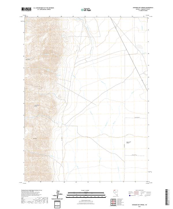
2021 Map of Howard Hot Spring
USGS Topo · Published 2021About this map
Howard Hot Spring marks a geothermal point on the northeastern edge of the Pine Forest Range in northern Nevada. The landscape is defined by the dramatic shift from the high elevation of Mt Baldy down into the northern reaches of the Black Rock Desert. This map illustrates a complex drainage system where seasonal and perennial waters like Rattlesnake Cr, Boyd Cr, and Granite Cr descend from the basin heights toward the desert floor.
Find a feature on this map
26 named features on this map. Tap any name to fly to it.
Don’t see what you’re looking for? This feature index may not catch every label — zoom into the map to look around manually.
Map Details
Editions of this 2021 Howard Hot Spring Map
This is the sole edition of this map. No revisions or reprints were ever made.
Other maps of this area

1886 · Disaster
USGS Topo · 1:250,000

1893 · Disaster
USGS Topo · 1:250,000

1954 · Vya
USGS Topo · 1:250,000

1958 · Vya
USGS Topo · 1:250,000

1961 · Quinn River Crossing
USGS Topo · 1:62,500

1961 · Trident Peak
USGS Topo · 1:62,500

1962 · Vya
USGS Topo · 1:250,000

1965 · Duffer Peak
USGS Topo · 1:62,500

1966 · Denio
USGS Topo · 1:62,500

1979 · Denio
USGS Topo · 1:100,000