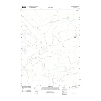
2010 Map of Howard NW
USGS Topo · Published 2010About this map
Shoemaker Ridge and the high elevations of the Allegheny Plateau dominate this Clinton County landscape, which is defined by a dense network of forest roads and trails rather than residential settlements. In the early 21st century, the area remains a managed wilderness, marked by distinctive landforms like Dishpan Hollow and Conklin Hollow. The Coffin Rock Fire Tower stands as a primary landmark in the northwest, overlooking the deep drainages of Clendenin Branch and Rock Run. This terrain is intersected by an extensive system of access routes including Eagleton RD and the evocative Slaughtering Ground RD, while the southern reaches are drained by the North Fork Tangascootack Creek. The presence of large clearings like Eagleton Fields amidst the timbered ridges suggests a history of land use tied to both forestry and conservation.
Find a feature on this map
57 named features on this map. Tap any name to fly to it.
Don’t see what you’re looking for? This feature index may not catch every label — zoom into the map to look around manually.
Map Details
Editions of this 2010 Howard NW Map
This is the sole edition of this map. No revisions or reprints were ever made.
Other maps of this area

1921 · Howard
USGS Topo · 1:48,000

1923 · Howard
USGS Topo · 1:62,500

1928 · Snow Shoe
USGS Topo · 1:48,000

1931 · Show Shoe
USGS Topo · 1:62,500

1943 · Hyner
USGS Topo · 1:62,500

1946 · Renovo East
USGS Topo · 1:62,500

1946 · Renovo West
USGS Topo · 1:62,500

1946 · Renovo East
USGS Topo · 1:24,000

1946 · Renovo West
USGS Topo · 1:24,000

1946 · Glen Union
USGS Topo · 1:24,000
Featured Places
- Bald Eagle Township, PA
- Beech Creek Township, PA
- Noyes Township, PA
- Grugan Township, PA
- Bear Swamp, Beech Creek Township