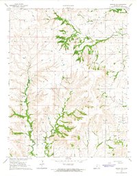
1964 Map of Howard NW
USGS Topo · Published 1965About this map
The Old Indian Treaty Boundary slices across the northern landscape of Elk County, marking a significant historical line through Union Center and Greenfield townships. In the mid-1960s, this region of Kansas supported a dual economy of ranching and petroleum extraction. The drainage of the Caney River and its tributaries, such as Clear Creek and Bull Creek, dictates the rugged topography, where the Wild Cat terrain dominates the southeast.
Find a feature on this map
21 named features on this map. Tap any name to fly to it.
Don’t see what you’re looking for? This feature index may not catch every label — zoom into the map to look around manually.
Map Details
Editions of this 1964 Howard NW Map
2 editions found
Other maps of this area

1885 · Eureka
USGS Topo · 1:125,000

1885 · Sedan
USGS Topo · 1:125,000

1888 · Eureka
USGS Topo · 1:125,000

1888 · Eldorado
USGS Topo · 1:125,000

1889 · Burden
USGS Topo · 1:125,000

1889 · Sedan
USGS Topo · 1:125,000

1894 · Eureka
USGS Topo · 1:125,000

1955 · Wichita
USGS Topo · 1:250,000

1958 · Wichita
USGS Topo · 1:250,000

1962 · Moline
USGS Topo · 1:24,000