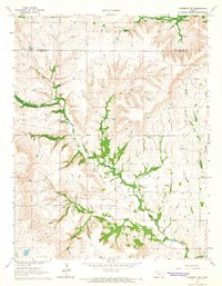
1964 Map of Piedmont SW
USGS Topo · Published 1965About this map
Elk River and its intricate drainage system define the topography of this region along the Greenwood and Elk County line in the mid-1960s. The landscape is characterized by the confluence of the South Branch Elk River and the winding Otter Creek system, including its South Branch. Human activity is concentrated around natural resources and transportation corridors, most notably the St Louis San Francisco railroad cutting across the northern reaches. The presence of the Roby Oil Field indicates the importance of petroleum extraction to the local economy during this era. In the southeastern portion of the quadrangle, Forest Cem provides a specific point of interest for genealogists tracing family histories in Union Center. This survey reveals a rural Kansas environment where industrial infrastructure like the railroad and oil fields exists alongside established land boundaries and watercourses.
Find a feature on this map
9 named features on this map. Tap any name to fly to it.
Don’t see what you’re looking for? This feature index may not catch every label — zoom into the map to look around manually.
Map Details
Editions of this 1964 Piedmont SW Map
This is the sole edition of this map. No revisions or reprints were ever made.
Other maps of this area

1885 · Eureka
USGS Topo · 1:125,000

1885 · Sedan
USGS Topo · 1:125,000

1888 · Eureka
USGS Topo · 1:125,000

1888 · Eldorado
USGS Topo · 1:125,000

1889 · Burden
USGS Topo · 1:125,000

1889 · Sedan
USGS Topo · 1:125,000

1894 · Eureka
USGS Topo · 1:125,000

1955 · Wichita
USGS Topo · 1:250,000

1958 · Wichita
USGS Topo · 1:250,000
1964 · Howard
USGS Topo · 1:24,000