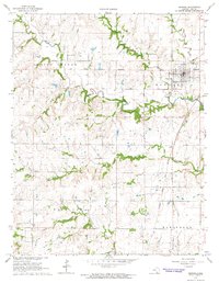
1964 Map of Howard
USGS Topo · Published 1965About this map
Howard serves as the primary hub in this mid-1960s Kansas landscape, situated near the confluence of the Elk River and Pawpaw Creek. The town is well-supported by local infrastructure including the Fairground, Waterworks, and nearby Elk County Airport. Cultural and educational landmarks like the Union Center Sch and Howard Cemetery reflect the established community, while the landscape reveals a history of land partition through the Old Indian Treaty Boundary that bisects the northern sections.
Find a feature on this map
25 named features on this map. Tap any name to fly to it.
Don’t see what you’re looking for? This feature index may not catch every label — zoom into the map to look around manually.
Map Details
Editions of this 1964 Howard Map
2 editions found
Other maps of this area

1885 · Eureka
USGS Topo · 1:125,000

1885 · Sedan
USGS Topo · 1:125,000

1888 · Eureka
USGS Topo · 1:125,000

1889 · Sedan
USGS Topo · 1:125,000

1894 · Eureka
USGS Topo · 1:125,000

1939 · Severy
USGS Topo · 1:62,500

1941 · Severy
USGS Topo · 1:62,500

1955 · Wichita
USGS Topo · 1:250,000

1958 · Wichita
USGS Topo · 1:250,000

1962 · Moline
USGS Topo · 1:24,000