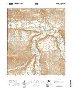
2020 Map of Howard Pass D-3 NW
USGS Topo · Published 2020About this map
Colville River and the Kuna River dominate this Arctic landscape in the Howard Pass region of the North Slope. The terrain is characterized by the prominent elevation of Etigonik Mtn in the west, while the rivers meander through a series of survey townships including t5s r25w, t5s r24w, t6s r25w, and t6s r24w. This 2020 topographic record shows the intersection of these two significant northern waterways, illustrating the natural drainage patterns across a high-latitude wilderness devoid of modern infrastructure or permanent settlements.
Find a feature on this map
7 named features on this map. Tap any name to fly to it.
Don’t see what you’re looking for? This feature index may not catch every label — zoom into the map to look around manually.
Map Details
Editions of this 2020 Howard Pass D-3 NW Map
This is the sole edition of this map. No revisions or reprints were ever made.
Other maps of this area

1951 · Lookout Ridge
USGS Topo · 1:250,000

1951 · Howard Pass
USGS Topo · 1:250,000

1956 · Lookout Ridge
USGS Topo · 1:250,000

1956 · Howard Pass
USGS Topo · 1:250,000
1984 · Howard Pass D-4
USGS Topo · 1:63,360
1984 · Howard Pass D-3
USGS Topo · 1:63,360
1984 · Lookout Ridge A-4
USGS Topo · 1:63,360
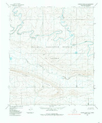
1984 · Lookout Ridge A-3
USGS Topo · 1:63,360
2016 · Lookout Ridge A-3 SW
USGS Topo · 1:25,000
2016 · Lookout Ridge A-3 SE
USGS Topo · 1:25,000