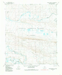
1984 Map of Lookout Ridge A-4
USGS Topo · Published 1985About this map
National Petroleum Reserve in Alaska dominates this 1984 survey, illustrating a massive expanse of the North Slope where the Arctic landscape remains largely defined by its natural water systems. The Awuna River meanders across the northern portion of the quadrangle, while the southern boundary is shaped by the wide course of the Colville River and its tributary, Grayling Creek.
Find a feature on this map
14 named features on this map. Tap any name to fly to it.
Don’t see what you’re looking for? This feature index may not catch every label — zoom into the map to look around manually.
Map Details
Editions of this 1984 Lookout Ridge A-4 Map
This is the sole edition of this map. No revisions or reprints were ever made.
Other maps of this area

1951 · Lookout Ridge
USGS Topo · 1:250,000

1951 · Howard Pass
USGS Topo · 1:250,000

1956 · Lookout Ridge
USGS Topo · 1:250,000

1956 · Howard Pass
USGS Topo · 1:250,000
1984 · Howard Pass D-4
USGS Topo · 1:63,360
1984 · Howard Pass D-5
USGS Topo · 1:63,360
1984 · Howard Pass D-3
USGS Topo · 1:63,360
1984 · Lookout Ridge A-3
USGS Topo · 1:63,360
1984 · Lookout Ridge A-5
USGS Topo · 1:63,360
1985 · Lookout Ridge B-5
USGS Topo · 1:63,360