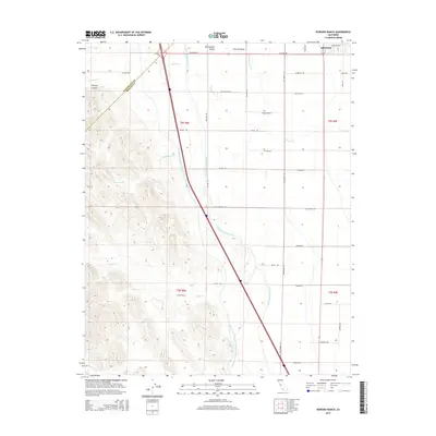
2015 Map of Howard Ranch
USGS Topo · Published 2015About this map
The San Joaquin Valley is defined here by the meeting of massive infrastructure and the varying terrain of the Diablo Range foothills. Two parallel arteries, the Governor Edmund G Brown California Aqueduct and the Delta-Mendota Canal, dominate the landscape as they channel water through the arid valley floor. To the west, the topography rises sharply into the hills of Whitney Canyon, where seasonal drainages like Quinto Creek and Mustang Creek carve their way toward the lowlands.
Find a feature on this map
40 named features on this map. Tap any name to fly to it.
Don’t see what you’re looking for? This feature index may not catch every label — zoom into the map to look around manually.
Map Details
Editions of this 2015 Howard Ranch Map
This is the sole edition of this map. No revisions or reprints were ever made.
Other maps of this area

1917 · Newman
USGS Topo · 1:31,680

1918 · Gustine
USGS Topo · 1:31,680

1919 · Orestimba
USGS Topo · 1:62,500

1919 · Orestimba Creek
USGS Topo · 1:31,680

1919 · Ingomar
USGS Topo · 1:31,680

1920 · Pacheco Pass
USGS Topo · 1:62,500

1921 · Volta
USGS Topo · 1:31,680

1922 · San Luis Creek
USGS Topo · 1:31,680

1922 · Howard Ranch
USGS Topo · 1:31,680

1940 · Pacheco Pass
USGS Topo · 1:62,500