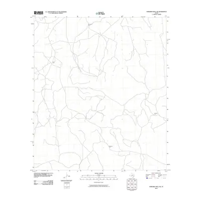
2010 Map of Howards Well NE
USGS Topo · Published 2010About this map
Montgomery Ranch and Pierce Ranch anchor the northern landscape of this Crockett County quadrangle, representing the enduring livestock and ranching heritage of West Texas. The terrain is defined by a complex network of seasonal drainage channels and unpaved roads that connect these isolated homesteads across the arid plains. In the southeast, the holdings of the Childress family are prominent, split between the R Childress Ranch and the W Childress Ranch. This 2010 survey reflects a landscape of vast property lines and sparse settlement, where the infrastructure of the cattle industry—fences, dirt tracks, and remote outbuildings—dictates the human footprint. The map captures the spatial layout of these family-named operations at the start of the 2010s, providing a clear view of the rural land divisions in this part of the state.
Find a feature on this map
4 named features on this map. Tap any name to fly to it.
Don’t see what you’re looking for? This feature index may not catch every label — zoom into the map to look around manually.
Map Details
Editions of this 2010 Howards Well NE Map
This is the sole edition of this map. No revisions or reprints were ever made.
Other maps of this area

1954 · Sonora
USGS Topo · 1:250,000

1958 · Sonora
USGS Topo · 1:250,000

1967 · Baggett Ranch
USGS Topo · 1:24,000

1967 · Hunt Ranch
USGS Topo · 1:24,000

1967 · Mitchell Canyon
USGS Topo · 1:24,000

1970 · Howards Well NE
USGS Topo · 1:24,000

1970 · Aermotor Draw
USGS Topo · 1:24,000

1970 · Indian Draw
USGS Topo · 1:24,000

1970 · Howards Well
USGS Topo · 1:24,000

1970 · Howards Well SW
USGS Topo · 1:24,000