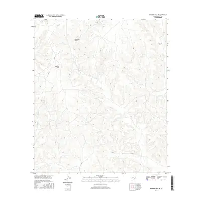
2016 Map of Howards Well NE
USGS Topo · Published 2016About this map
Government Canyon dominates the northern reaches of this Crockett County landscape, illustrating the intricate drainage patterns of the Edwards Plateau. The terrain is defined by complex contouring and significant elevation changes, where seasonal watercourses like Sevenmile Draw and Anderson Draw have carved deep into the limestone. Human activity is represented primarily by a network of ranch roads and county routes, including Co Rd 401 and Cr 106, which traverse the high divides between canyons. The sparse infrastructure, consisting largely of these dirt and gravel paths, highlights the rural ranching character of this West Texas region. This 2016 survey provides a precise record of the physical geography and existing road network, from the junction of Co Rd 402 to the northern reaches near Dove St.
Find a feature on this map
9 named features on this map. Tap any name to fly to it.
Don’t see what you’re looking for? This feature index may not catch every label — zoom into the map to look around manually.
Map Details
Editions of this 2016 Howards Well NE Map
This is the sole edition of this map. No revisions or reprints were ever made.
Other maps of this area

1954 · Sonora
USGS Topo · 1:250,000

1958 · Sonora
USGS Topo · 1:250,000

1967 · Baggett Ranch
USGS Topo · 1:24,000

1967 · Hunt Ranch
USGS Topo · 1:24,000

1967 · Mitchell Canyon
USGS Topo · 1:24,000

1970 · Howards Well NE
USGS Topo · 1:24,000

1970 · Aermotor Draw
USGS Topo · 1:24,000

1970 · Indian Draw
USGS Topo · 1:24,000

1970 · Howards Well
USGS Topo · 1:24,000

1970 · Howards Well SW
USGS Topo · 1:24,000