
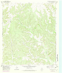
1970 Map of Howards Well NE
USGS Topo · Published 1973About this map
Government Canyon and Sevenmile Draw dominate the topography of this portion of Crockett County, where the landscape is defined by the drainage patterns of the Edwards Plateau. The map reveals the isolation of West Texas ranching life during the late 1960s, centered on family-held properties such as Montgomery Ranch, Pierce Ranch, and the W Childress Ranch. This era of land use is characterized by a reliance on private infrastructure, evidenced by a remote Landing Strip and a network of Private roads connecting scattered homesteads.
Find a feature on this map
12 named features on this map. Tap any name to fly to it.
Don’t see what you’re looking for? This feature index may not catch every label — zoom into the map to look around manually.
Map Details
Editions of this 1970 Howards Well NE Map
2 editions found
Other maps of this area

1954 · Sonora
USGS Topo · 1:250,000

1958 · Sonora
USGS Topo · 1:250,000

1967 · Baggett Ranch
USGS Topo · 1:24,000

1967 · Hunt Ranch
USGS Topo · 1:24,000

1967 · Mitchell Canyon
USGS Topo · 1:24,000

1970 · Aermotor Draw
USGS Topo · 1:24,000

1970 · Indian Draw
USGS Topo · 1:24,000

1970 · Howards Well
USGS Topo · 1:24,000

1970 · Howards Well SW
USGS Topo · 1:24,000
1970 · Harrell Canyon
USGS Topo · 1:24,000