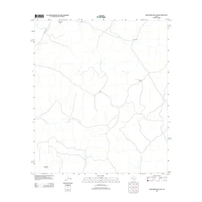
2012 Map of Howards Well SW
USGS Topo · Published 2012About this map
Watson Ranch and Kincaid Ranch define the settlement pattern of this rural West Texas landscape during the early 21st century. The terrain is deeply marked by the winding path of Escondido Canyon in the southwest and Sevenmile Draw to the north, illustrating the complex drainage systems typical of Val Verde County. A sparse network of roads, including Ranch Road 2083 and Co Rd 402, provides the primary access through this arid environment. The map details a region where large-scale ranching operations are the dominant human footprint, with isolated homesteads connected by long stretches of unpaved tracks like Clegg Rd.
Find a feature on this map
7 named features on this map. Tap any name to fly to it.
Don’t see what you’re looking for? This feature index may not catch every label — zoom into the map to look around manually.
Map Details
Editions of this 2012 Howards Well SW Map
This is the sole edition of this map. No revisions or reprints were ever made.
Other maps of this area

1954 · Sonora
USGS Topo · 1:250,000

1958 · Sonora
USGS Topo · 1:250,000

1970 · Howards Well NE
USGS Topo · 1:24,000

1970 · Antone Canyon
USGS Topo · 1:24,000

1970 · Aermotor Draw
USGS Topo · 1:24,000

1970 · Pandale
USGS Topo · 1:24,000

1970 · Steel Star Draw
USGS Topo · 1:24,000

1970 · Howards Well
USGS Topo · 1:24,000

1970 · Howards Well SW
USGS Topo · 1:24,000
1970 · Divide Well Draw
USGS Topo · 1:24,000