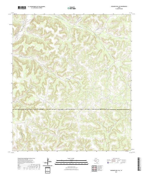
2022 Map of Howards Well SW
USGS Topo · Published 2022About this map
The confluence of the Crockett Co and Val Verde Co boundary lines this arid West Texas landscape, defined by a complex network of seasonal drainages and canyons. The terrain is deeply incised by major features like Sevenmile Draw, Howard Draw, and Jesus Canyon, which illustrate the natural watershed patterns of the Edwards Plateau. This modern survey shows a sparsely populated ranching region where access is maintained through a web of named tracks such as Chisholm Rd, Big Canyon Rd, and Clegg Rd.
Find a feature on this map
19 named features on this map. Tap any name to fly to it.
Don’t see what you’re looking for? This feature index may not catch every label — zoom into the map to look around manually.
Map Details
Editions of this 2022 Howards Well SW Map
This is the sole edition of this map. No revisions or reprints were ever made.
Other maps of this area

1954 · Sonora
USGS Topo · 1:250,000

1958 · Sonora
USGS Topo · 1:250,000

1970 · Howards Well NE
USGS Topo · 1:24,000

1970 · Antone Canyon
USGS Topo · 1:24,000

1970 · Aermotor Draw
USGS Topo · 1:24,000

1970 · Pandale
USGS Topo · 1:24,000

1970 · Steel Star Draw
USGS Topo · 1:24,000

1970 · Howards Well
USGS Topo · 1:24,000

1970 · Howards Well SW
USGS Topo · 1:24,000
1970 · Divide Well Draw
USGS Topo · 1:24,000