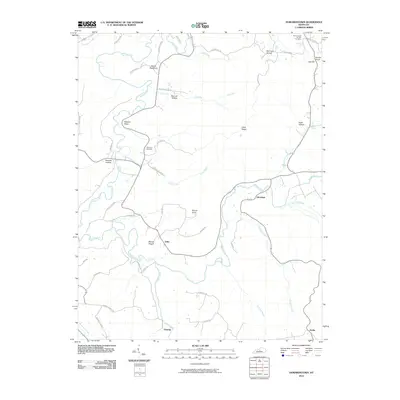
2010 Map of Howardstown
USGS Topo · Published 2010About this map
Rolling Fork carves a winding path through this central Kentucky landscape, defining the topography for rural settlements like Stiles, Gleanings, and Ginseng. The area is characterized by a series of narrow hollows and ridges, including the prominent Devils Backbone and Cecil Ridge. These landforms dictate the placement of winding country roads such as Gaddys Ford Rd and Blanton Ford Rd, which follow the natural contours and creek beds.
Find a feature on this map
55 named features on this map. Tap any name to fly to it.
Don’t see what you’re looking for? This feature index may not catch every label — zoom into the map to look around manually.
Map Details
Editions of this 2010 Howardstown Map
This is the sole edition of this map. No revisions or reprints were ever made.
Other maps of this area

1953 · Howardstown
USGS Topo · 1:24,000

1953 · Loretto
USGS Topo · 1:24,000

1953 · Nelsonville
USGS Topo · 1:24,000

1953 · Saloma
USGS Topo · 1:24,000

1953 · Hibernia
USGS Topo · 1:24,000

1953 · New Haven
USGS Topo · 1:24,000

1953 · Magnolia
USGS Topo · 1:24,000
1953 · Hodgenville
USGS Topo · 1:24,000

1953 · Raywick
USGS Topo · 1:24,000

1957 · Winchester
USGS Topo · 1:250,000