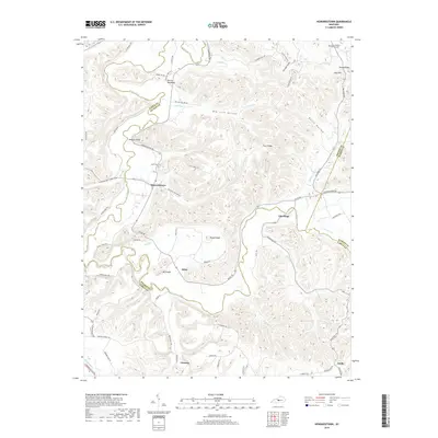
2019 Map of Howardstown
USGS Topo · Published 2019About this map
Rolling Fork winds through the borderlands of Nelson, Larue, and Marion Counties, anchoring a rural landscape defined by deep hollows and prominent ridges. Small agricultural hubs like Howardstown and Gleanings sit amidst the relief, connected by historical routes such as Howardstown Rd and Gleanings Rd. The presence of Saint Ann Cem near the town center and Saint Vincent De Paul Cem to the northeast provides essential locations for genealogical research in this long-settled part of Kentucky.
Find a feature on this map
70 named features on this map. Tap any name to fly to it.
Don’t see what you’re looking for? This feature index may not catch every label — zoom into the map to look around manually.
Map Details
Editions of this 2019 Howardstown Map
This is the sole edition of this map. No revisions or reprints were ever made.
Other maps of this area

1953 · Howardstown
USGS Topo · 1:24,000

1953 · Loretto
USGS Topo · 1:24,000

1953 · Nelsonville
USGS Topo · 1:24,000

1953 · Saloma
USGS Topo · 1:24,000

1953 · Hibernia
USGS Topo · 1:24,000

1953 · New Haven
USGS Topo · 1:24,000

1953 · Magnolia
USGS Topo · 1:24,000
1953 · Hodgenville
USGS Topo · 1:24,000

1953 · Raywick
USGS Topo · 1:24,000

1957 · Winchester
USGS Topo · 1:250,000