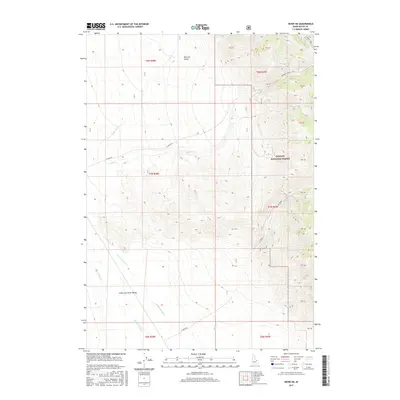
2017 Map of Howe NE
USGS Topo · Published 2017About this map
Challis National Forest dominates the rugged eastern half of this terrain, where steep ridges descend into a complex drainage system. High mountain watersheds feed seasonal and perennial flows including Uncle Ike Cr, North Cr, and Camp Cr, which move westward toward the alluvial plains. The topography shifts dramatically as the land drops into the broad Little Lost River Valley, a prominent basin defined by the course of the Little Lost River. Transportation in this remote part of Butte County is limited to backcountry routes like N Creek Rd and the N Creek Trail, which provide access to the high country and features like Mormon Gulch. The map captures the transition from protected forest highlands to the arid valley floor, where Warm Spring Cr winds through the lower elevations.
Find a feature on this map
29 named features on this map. Tap any name to fly to it.
Don’t see what you’re looking for? This feature index may not catch every label — zoom into the map to look around manually.
Map Details
Editions of this 2017 Howe NE Map
This is the sole edition of this map. No revisions or reprints were ever made.
Other maps of this area

1955 · Dubois
USGS Topo · 1:250,000

1955 · Idaho Falls
USGS Topo · 1:250,000

1957 · Diamond Peak
USGS Topo · 1:62,500

1958 · Dubois
USGS Topo · 1:250,000

1958 · Idaho Falls
USGS Topo · 1:250,000

1969 · Arco Pass
USGS Topo · 1:24,000

1969 · Little Lost River Sinks
USGS Topo · 1:24,000

1969 · Eightmile Canyon
USGS Topo · 1:24,000

1969 · Tyler Peak
USGS Topo · 1:24,000

1969 · Howe
USGS Topo · 1:24,000