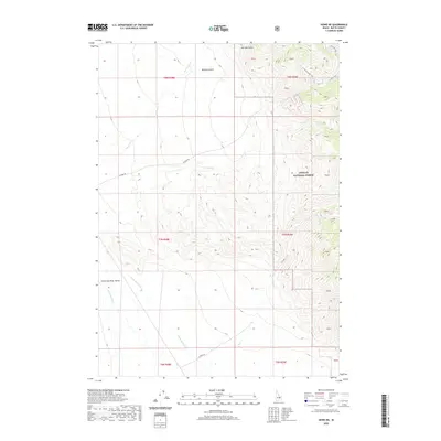
2020 Map of Howe NE
USGS Topo · Published 2020About this map
The Little Lost River Valley forms a wide alluvial basin in the southwestern portion of this Butte County region, where the Little Lost River winds through the floor of the valley. To the east, the landscape rises into the protected boundaries of the Challis National Forest, a terrain of steep drainages and ridge systems. Historical movement through the area is traced by N Creek Rd and the N Creek Trail, which navigate the foothills and canyons. Water sources are critical in this arid high-desert environment, evidenced by the named drainages of Warm Spring Cr, Uncle Ike Cr, and Mormon Gulch. The map identifies several Bureau of Land Management parcels and public tracts, including Camp Cr and S Creek, highlighting the region's managed wilderness character and complex topography.
Find a feature on this map
29 named features on this map. Tap any name to fly to it.
Don’t see what you’re looking for? This feature index may not catch every label — zoom into the map to look around manually.
Map Details
Editions of this 2020 Howe NE Map
This is the sole edition of this map. No revisions or reprints were ever made.
Other maps of this area

1955 · Dubois
USGS Topo · 1:250,000

1955 · Idaho Falls
USGS Topo · 1:250,000

1957 · Diamond Peak
USGS Topo · 1:62,500

1958 · Dubois
USGS Topo · 1:250,000

1958 · Idaho Falls
USGS Topo · 1:250,000

1969 · Arco Pass
USGS Topo · 1:24,000

1969 · Little Lost River Sinks
USGS Topo · 1:24,000

1969 · Eightmile Canyon
USGS Topo · 1:24,000

1969 · Tyler Peak
USGS Topo · 1:24,000

1969 · Howe
USGS Topo · 1:24,000