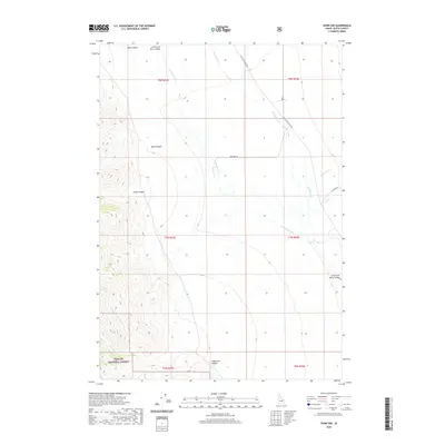
2020 Map of Howe NW
USGS Topo · Published 2020About this map
Little Lost River Valley forms the heart of this high-altitude drainage in Butte County, where the desert-like basin floor meets the steep southern slopes of the mountains. The perennial flow of the Little Lost River winds through the center of the sheet, supported by tributaries such as Big Spring Cr and Uncle Ike Cr. The landscape is defined by its deep drainage patterns, with prominent features like Sands Canyon, Buck Canyon, and Cedarville Canyon cutting into the western hillsides. Human presence is concentrated along the Little Lost River Hwy, the primary corridor through this ranching territory. To the southwest, the boundary of the Challis National Forest marks the transition into more rugged timberland, where the Cabin Fork and N Fork Cabin Fork descend from the high peaks.
Find a feature on this map
21 named features on this map. Tap any name to fly to it.
Don’t see what you’re looking for? This feature index may not catch every label — zoom into the map to look around manually.
Map Details
Editions of this 2020 Howe NW Map
This is the sole edition of this map. No revisions or reprints were ever made.
Other maps of this area

1955 · Dubois
USGS Topo · 1:250,000

1955 · Idaho Falls
USGS Topo · 1:250,000

1957 · Diamond Peak
USGS Topo · 1:62,500

1957 · Hawley Mountain
USGS Topo · 1:62,500

1958 · Dubois
USGS Topo · 1:250,000

1958 · Idaho Falls
USGS Topo · 1:250,000

1969 · Arco Pass
USGS Topo · 1:24,000

1969 · Ramshorn Canyon
USGS Topo · 1:24,000

1969 · Howe
USGS Topo · 1:24,000

1969 · Howe NW
USGS Topo · 1:24,000