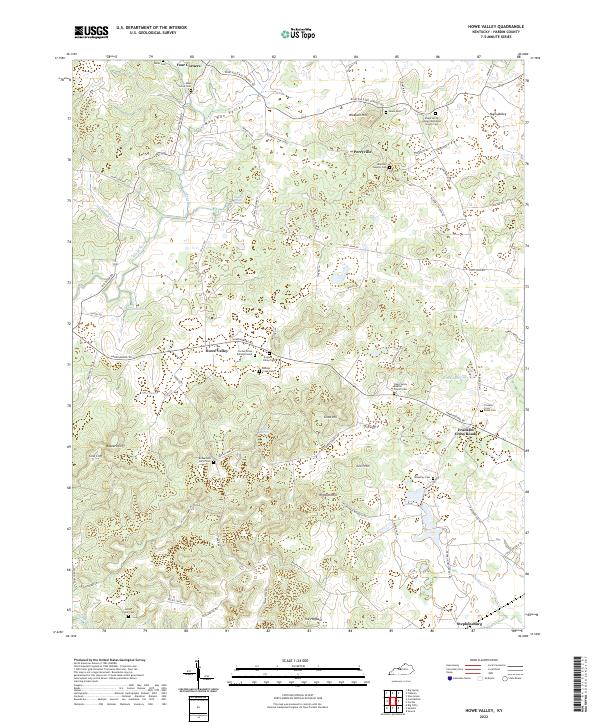
2022 Map of Howe Valley
USGS Topo · Published 2022About this map
Howe Valley and the surrounding Hardin County uplands are defined by a complex network of springs and valleys that have long shaped local settlement patterns. Groundwater is a prominent feature of this karst landscape, evidenced by Head of Rough Spring, Pirtle Spring, and the subterranean flow suggested by Roaring Spring. These water sources feed the upper reaches of the Rough River and Sutzer Creek, creating a series of well-defined hollows like Moorman Valley and Nalls Valley.
Find a feature on this map
82 named features on this map. Tap any name to fly to it.
Don’t see what you’re looking for? This feature index may not catch every label — zoom into the map to look around manually.
Map Details
Editions of this 2022 Howe Valley Map
This is the sole edition of this map. No revisions or reprints were ever made.
Other maps of this area

1932 · Big Clifty
USGS Topo · 1:62,500

1935 · Elizabethtown
USGS Topo · 1:48,000

1936 · Vine Grove
USGS Topo · 1:62,500

1938 · Elizabethtown
USGS Topo · 1:62,500

1941 · Ekron
USGS Topo · 1:62,500

1943 · Vine Grove
USGS Topo · 1:62,500

1946 · Vine Grove
USGS Topo · 1:24,000

1946 · Vine Grove
USGS Topo · 1:62,500

1947 · Ekron
USGS Topo · 1:62,500
1948 · Flaherty
USGS Topo · 1:24,000