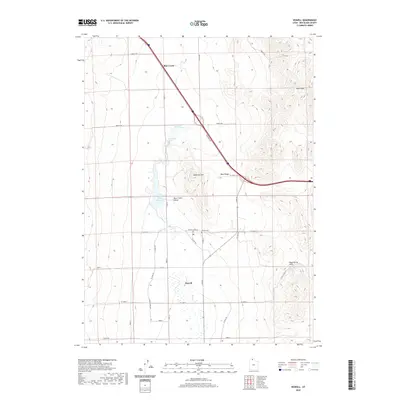
2020 Map of Howell
USGS Topo · Published 2020About this map
The agricultural landscape of Howell dominates the southern portion of this northern Utah survey, centered near the local Post Office and the Howell Cemetery. The valley floor is defined by a complex network of irrigation and drainage infrastructure, including the N West Canal Rd, W Canal St, and E Canal Rd, which manage the flow of Blue Creek as it moves south through the Blue Creek Valley.
Find a feature on this map
33 named features on this map. Tap any name to fly to it.
Don’t see what you’re looking for? This feature index may not catch every label — zoom into the map to look around manually.
Map Details
Editions of this 2020 Howell Map
This is the sole edition of this map. No revisions or reprints were ever made.
Other maps of this area

1954 · Brigham City
USGS Topo · 1:250,000

1958 · Brigham City
USGS Topo · 1:250,000

1961 · Thatcher Mountain
USGS Topo · 1:62,500

1962 · Brigham City
USGS Topo · 1:250,000

1968 · Sunset Pass
USGS Topo · 1:24,000
1968 · Limekiln Knoll
USGS Topo · 1:24,000

1968 · Howell
USGS Topo · 1:24,000

1968 · Ridgedale Pass
USGS Topo · 1:24,000
1968 · Blind Springs
USGS Topo · 1:24,000

1968 · Rattlesnake Pass
USGS Topo · 1:24,000