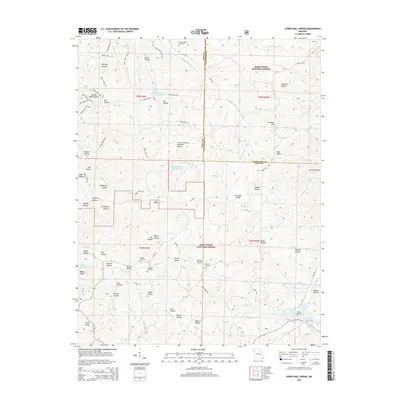
2015 Map of Howes Mill Spring
USGS Topo · Published 2015About this map
Ark serves as the central settlement point in this section of the Ozarks, surrounded by the protected lands of the Mark Twain National Forest. The landscape is defined by an intricate network of hollows, including Deerpen Hollow, Onion Hollow, and Plugtown Hollow, which drain into systems like Middle Prong Crooked Cr and Water Fork Cr. This 2015 edition documents the enduring rural character of Dent and Crawford Counties, where numerous family cemeteries like Hutson-Walker Cemetery, Kittenger Cemetery, and Hughes Cemetery are preserved in the hills. The presence of Howes Mill Spring and Wishing Spring highlights the region's karstic water features, while locations like Tiefenthalers Lake Retreat suggest the intersection of conservation land and private recreational development. Transportation is primarily facilitated by rugged forest service roads and county routes that trace the ridges above the deep hollows.
Find a feature on this map
85 named features on this map. Tap any name to fly to it.
Don’t see what you’re looking for? This feature index may not catch every label — zoom into the map to look around manually.
Map Details
Editions of this 2015 Howes Mill Spring Map
This is the sole edition of this map. No revisions or reprints were ever made.
Other maps of this area

1932 · Steelville
USGS Topo · 1:48,000

1933 · Steelville
USGS Topo · 1:62,500

1937 · Steelville
USGS Topo · 1:62,500

1941 · Stone Hill
USGS Topo · 1:62,500

1943 · Berryman
USGS Topo · 1:62,500

1943 · Boss
USGS Topo · 1:62,500

1945 · Stone Hill
USGS Topo · 1:62,500

1945 · Berryman
USGS Topo · 1:62,500

1946 · Boss
USGS Topo · 1:62,500

1949 · Rolla
USGS Topo · 1:250,000