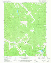
1981 Map of Howes Mill Spring
USGS Topo · Published 1981About this map
Howes Mill and the surrounding Ozark landscape in Dent and Crawford counties are defined here by a network of steep hollows and cold water springs. In the south, the namesake Howes Mill Spring feeds into Huzzah Creek, near the Howes Mill Union Ch and Hughes Cem. This area reveals a transition from the industrial and agricultural past to state-managed conservation, evidenced by the Fish Hatcheries (Abandoned) located along the creek and the vast acreage of the Indian Trail State Forest to the north.
Find a feature on this map
66 named features on this map. Tap any name to fly to it.
Don’t see what you’re looking for? This feature index may not catch every label — zoom into the map to look around manually.
Map Details
Editions of this 1981 Howes Mill Spring Map
This is the sole edition of this map. No revisions or reprints were ever made.
Other maps of this area

1932 · Steelville
USGS Topo · 1:48,000

1933 · Steelville
USGS Topo · 1:62,500

1937 · Steelville
USGS Topo · 1:62,500

1941 · Stone Hill
USGS Topo · 1:62,500

1943 · Berryman
USGS Topo · 1:62,500

1943 · Boss
USGS Topo · 1:62,500

1945 · Stone Hill
USGS Topo · 1:62,500

1945 · Berryman
USGS Topo · 1:62,500

1946 · Boss
USGS Topo · 1:62,500

1949 · Rolla
USGS Topo · 1:250,000