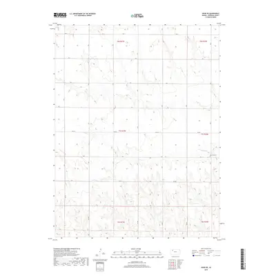
2018 Map of Hoxie NE
USGS Topo · Published 2018About this map
The northern plains of Sheridan County are defined by a rhythmic drainage system that feeds the Solomon River watershed. The watershed is dominated by the branching paths of Bow Cr and its southern tributary, S Bow Cr, which carve shallow valleys into the Kansas high plains. In this rural landscape, the grid of section roads—such as 100 N and RD 90 E—organizes the agricultural terrain. A quiet record of the area's early residents is preserved at the Bow Creek Cem, situated near the south bank of its namesake creek. Smaller drainages including Cortez Cr and Holly Cr flow through the southern reaches of the quadrangle, illustrating the subtle but persistent erosion patterns that have shaped this prairie environment over generations.
Find a feature on this map
25 named features on this map. Tap any name to fly to it.
Don’t see what you’re looking for? This feature index may not catch every label — zoom into the map to look around manually.
Map Details
Editions of this 2018 Hoxie NE Map
This is the sole edition of this map. No revisions or reprints were ever made.
Other maps of this area

1954 · Goodland
USGS Topo · 1:250,000

1956 · Goodland
USGS Topo · 1:250,000

1957 · Goodland
USGS Topo · 1:250,000

1978 · Clayton SW
USGS Topo · 1:24,000

1978 · Allison
USGS Topo · 1:24,000

1978 · Dresden South
USGS Topo · 1:24,000

1979 · Lucerne
USGS Topo · 1:24,000

1979 · Hoxie
USGS Topo · 1:24,000

1979 · Hoxie NE
USGS Topo · 1:24,000

1979 · Tasco
USGS Topo · 1:24,000