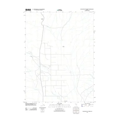
2011 Map of Hualapai Flat North
USGS Topo · Published 2011About this map
Hualapai Flat characterizes the high desert floor in this corner of Washoe County, where seasonal watercourses and remote ranching operations define the human imprint on the land. The presence of Iveson Ranch and Crossley 99 Ranch highlights the traditional agricultural use of the basin, connected by rural routes such as Barley Rd. The drainage network is shaped by intermittent flows from Negro Creek, Red Mountain Creek, and Cottonwood Creek, all descending from the surrounding heights toward the flat. To the north, the terrain transitions into the steep relief of Leadville Canyon, providing a stark contrast to the open basin. This survey documents the persistent rural character of the Great Basin landscape in the early 21st century, showing how modern ranching continues to rely on the natural geography of the canyons and alluvial fans.
Find a feature on this map
8 named features on this map. Tap any name to fly to it.
Don’t see what you’re looking for? This feature index may not catch every label — zoom into the map to look around manually.
Map Details
Editions of this 2011 Hualapai Flat North Map
This is the sole edition of this map. No revisions or reprints were ever made.
Other maps of this area

1886 · Granite Range
USGS Topo · 1:250,000

1889 · Long Valley
USGS Topo · 1:250,000

1894 · Granite Range
USGS Topo · 1:250,000

1954 · Vya
USGS Topo · 1:250,000

1955 · Lovelock
USGS Topo · 1:250,000

1958 · Vya
USGS Topo · 1:250,000

1959 · Lovelock
USGS Topo · 1:250,000

1962 · Vya
USGS Topo · 1:250,000

1980 · Melody Mountain
USGS Topo · 1:24,000
1980 · Leadville
USGS Topo · 1:24,000