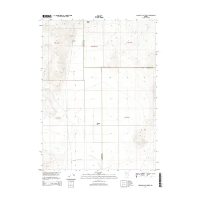
2014 Map of Hualapai Flat North
USGS Topo · Published 2014About this map
Hualapai Flat dominates this high-desert basin in northwest Nevada, where the convergence of three counties—Washoe, Humboldt, and Pershing—meets among a stark network of seasonal drainages and mountain ranges. The drainage patterns of Negro Cr, Red Mountain Cr, and Cottonwood Cr illustrate the arid hydrology of the region as they flow toward the alkali flats. In the eastern and northern portions of the quadrangle, the elevation rises sharply into the Calico Hills and the Division Range, providing a clear view of the topographic isolation characteristic of this part of the Great Basin.
Find a feature on this map
17 named features on this map. Tap any name to fly to it.
Don’t see what you’re looking for? This feature index may not catch every label — zoom into the map to look around manually.
Map Details
Editions of this 2014 Hualapai Flat North Map
This is the sole edition of this map. No revisions or reprints were ever made.
Other maps of this area

1886 · Granite Range
USGS Topo · 1:250,000

1889 · Long Valley
USGS Topo · 1:250,000

1894 · Granite Range
USGS Topo · 1:250,000

1954 · Vya
USGS Topo · 1:250,000

1955 · Lovelock
USGS Topo · 1:250,000

1958 · Vya
USGS Topo · 1:250,000

1959 · Lovelock
USGS Topo · 1:250,000

1962 · Vya
USGS Topo · 1:250,000

1980 · Melody Mountain
USGS Topo · 1:24,000
1980 · Leadville
USGS Topo · 1:24,000