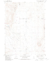
1980 Map of Hualapai Flat North
USGS Topo · Published 1980About this map
Iverson Ranch sits at the base of a high desert landscape where the Calico Hills meet the expansive floor of Hualapai Flat. This 1980 map records a remote corner of Nevada defined by scattered water sources and the necessities of ranching and light aviation, featuring both a Landing Field and a Landing Strip to navigate the distance between settlements. Waterways like Negro Creek and Leadville Canyon are critical markers in this arid environment, alongside several named springs.
Find a feature on this map
21 named features on this map. Tap any name to fly to it.
Don’t see what you’re looking for? This feature index may not catch every label — zoom into the map to look around manually.
Map Details
Editions of this 1980 Hualapai Flat North Map
This is the sole edition of this map. No revisions or reprints were ever made.
Other maps of this area

1886 · Granite Range
USGS Topo · 1:250,000

1889 · Long Valley
USGS Topo · 1:250,000

1894 · Granite Range
USGS Topo · 1:250,000

1954 · Vya
USGS Topo · 1:250,000

1955 · Lovelock
USGS Topo · 1:250,000

1958 · Vya
USGS Topo · 1:250,000

1959 · Lovelock
USGS Topo · 1:250,000

1962 · Vya
USGS Topo · 1:250,000

1980 · Melody Mountain
USGS Topo · 1:24,000
1980 · Leadville
USGS Topo · 1:24,000