
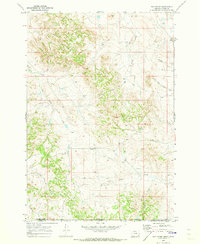
2011 Map of Huckins School
USGS Topo · Published 2011About this map
The Powder River meanders through this section of Powder River County, Montana, carving a path through a landscape defined by expansive drainages and isolated water management structures. In this arid ranching country, water is the primary architect of the land, as seen in the numerous named tributaries like Bay Horse Creek, Buttermilk Creek, and Hell Creek. The presence of several named earthen dams, including the Huckins Number 2 Dam and the United States Number 2 Dam, points to a history of careful water conservation and livestock management. Local transportation is represented by ranch roads such as Big Powder River East Rd and Bay Horse Rd, which follow the natural contours of features like Kelly Draw and Ellis Canyon.
Find a feature on this map
23 named features on this map. Tap any name to fly to it.
Don’t see what you’re looking for? This feature index may not catch every label — zoom into the map to look around manually.
Map Details
Editions of this 2011 Huckins School Map
This is the sole edition of this map. No revisions or reprints were ever made.
Other maps of this area

1954 · Ekalaka
USGS Topo · 1:250,000

1956 · Ekalaka
USGS Topo · 1:250,000

1958 · Ekalaka
USGS Topo · 1:250,000

1965 · Ekalaka
USGS Topo · 1:250,000

1966 · Hodsdon Flats
USGS Topo · 1:24,000

1970 · Moorhead
USGS Topo · 1:24,000

1970 · Baldy Peak
USGS Topo · 1:24,000

1970 · Bloom Creek
USGS Topo · 1:24,000

1970 · Huckins School
USGS Topo · 1:24,000
1970 · Bay Horse
USGS Topo · 1:24,000