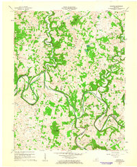
1961 Map of Hudgins
USGS Topo · Published 1963About this map
The Green River dominates this central Kentucky landscape, carving deep, dramatic meanders like Caven Bend and Lobb Bend across the Hart Co and Green Co border. This 1961 survey captures a rural landscape defined by isolated homesteads and small communities such as Hudgins and Eve. The area's hydrology is particularly distinct, featuring the noted Three Hundred Springs and the confluence where the Little Barren River meets the Green River near Defries.
Find a feature on this map
69 named features on this map. Tap any name to fly to it.
Don’t see what you’re looking for? This feature index may not catch every label — zoom into the map to look around manually.
Map Details
Editions of this 1961 Hudgins Map
This is the sole edition of this map. No revisions or reprints were ever made.
Other maps of this area

1934 · Munfordville
USGS Topo · 1:48,000

1935 · Horse Cave
USGS Topo · 1:48,000

1937 · Munfordville
USGS Topo · 1:62,500

1938 · Horse Cave
USGS Topo · 1:62,500

1953 · Hudgins
USGS Topo · 1:24,000

1953 · Hibernia
USGS Topo · 1:24,000

1953 · Summersville
USGS Topo · 1:24,000

1953 · Exie
USGS Topo · 1:24,000

1953 · Magnolia
USGS Topo · 1:24,000

1953 · Center
USGS Topo · 1:24,000