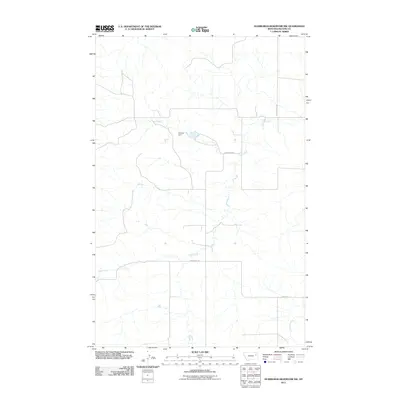
2011 Map of Hudiburgh Reservoir NW
USGS Topo · Published 2011About this map
Howard Dam serves as a central landmark in this ranching region of McCone County, capturing the remote character of eastern Montana. The landscape is defined by the winding paths of Cow Creek and Duck Creek, which carve through the terrain and dictate the local road network. Rural routes such as Thorgaard Rd and Stoney Rd provide the primary access to this sparsely populated area, following the natural contours of the drainages. This map illustrates the vital role of water management in a semi-arid environment, where named dams and seasonal creeks are the focal points of land use and navigation.
Find a feature on this map
7 named features on this map. Tap any name to fly to it.
Don’t see what you’re looking for? This feature index may not catch every label — zoom into the map to look around manually.
Map Details
Editions of this 2011 Hudiburgh Reservoir NW Map
This is the sole edition of this map. No revisions or reprints were ever made.
Other maps of this area

1954 · Glendive
USGS Topo · 1:250,000

1957 · Glendive
USGS Topo · 1:250,000

1958 · Glendive
USGS Topo · 1:250,000

1983 · Haynie Reservoir
USGS Topo · 1:24,000

1983 · Hudiburgh Reservoir
USGS Topo · 1:24,000

1983 · Pedigo Coulee
USGS Topo · 1:24,000

1983 · Dailey Spring
USGS Topo · 1:24,000

1983 · North Fork Horse Creek
USGS Topo · 1:24,000

1983 · Hudiburgh Reservoir NW
USGS Topo · 1:24,000
1983 · Sadie Coulee
USGS Topo · 1:24,000