
1983 Map of Hudiburgh Reservoir NW
USGS Topo · Published 1983About this map
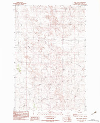
Cow Creek and Duck Creek define the drainage patterns of this high plains landscape in McCone County, as documented in this 1983 provisional survey. Based on aerial photography from the mid-1970s, the map reveals a remote area of eastern Montana where natural topography remains largely uninterrupted by dense settlement. The presence of a Gravel Pit suggests local extractive activity, likely supporting the network of unimproved roads and trails that traverse the hills. This document preserves the late twentieth-century state of the land before modern developments, showing the exact placement of ephemeral watercourses and localized industrial sites that are critical for understanding historical land use in this sparsely populated region.
Find a feature on this map
3 named features on this map. Tap any name to fly to it.
Don’t see what you’re looking for? This feature index may not catch every label — zoom into the map to look around manually.
Map Details
Editions of this 1983 Hudiburgh Reservoir NW Map
This is the sole edition of this map. No revisions or reprints were ever made.
Other maps of this area

1954 · Glendive
USGS Topo · 1:250,000

1957 · Glendive
USGS Topo · 1:250,000

1958 · Glendive
USGS Topo · 1:250,000

1983 · Haynie Reservoir
USGS Topo · 1:24,000

1983 · Hudiburgh Reservoir
USGS Topo · 1:24,000

1983 · Pedigo Coulee
USGS Topo · 1:24,000

1983 · Dailey Spring
USGS Topo · 1:24,000

1983 · North Fork Horse Creek
USGS Topo · 1:24,000
1983 · Sadie Coulee
USGS Topo · 1:24,000
1983 · Lone Pine School
USGS Topo · 1:24,000